OpenMMS supports research at the University of Kansas

Steve Rector, an undergraduate student at the University of Kansas (KU), recently submitted his presentation entitled, “A Low Cost UAV LiDAR System for Application at Archaeological Sites in Anatolia” to KU’s 2021 Undergraduate Research Symposium.

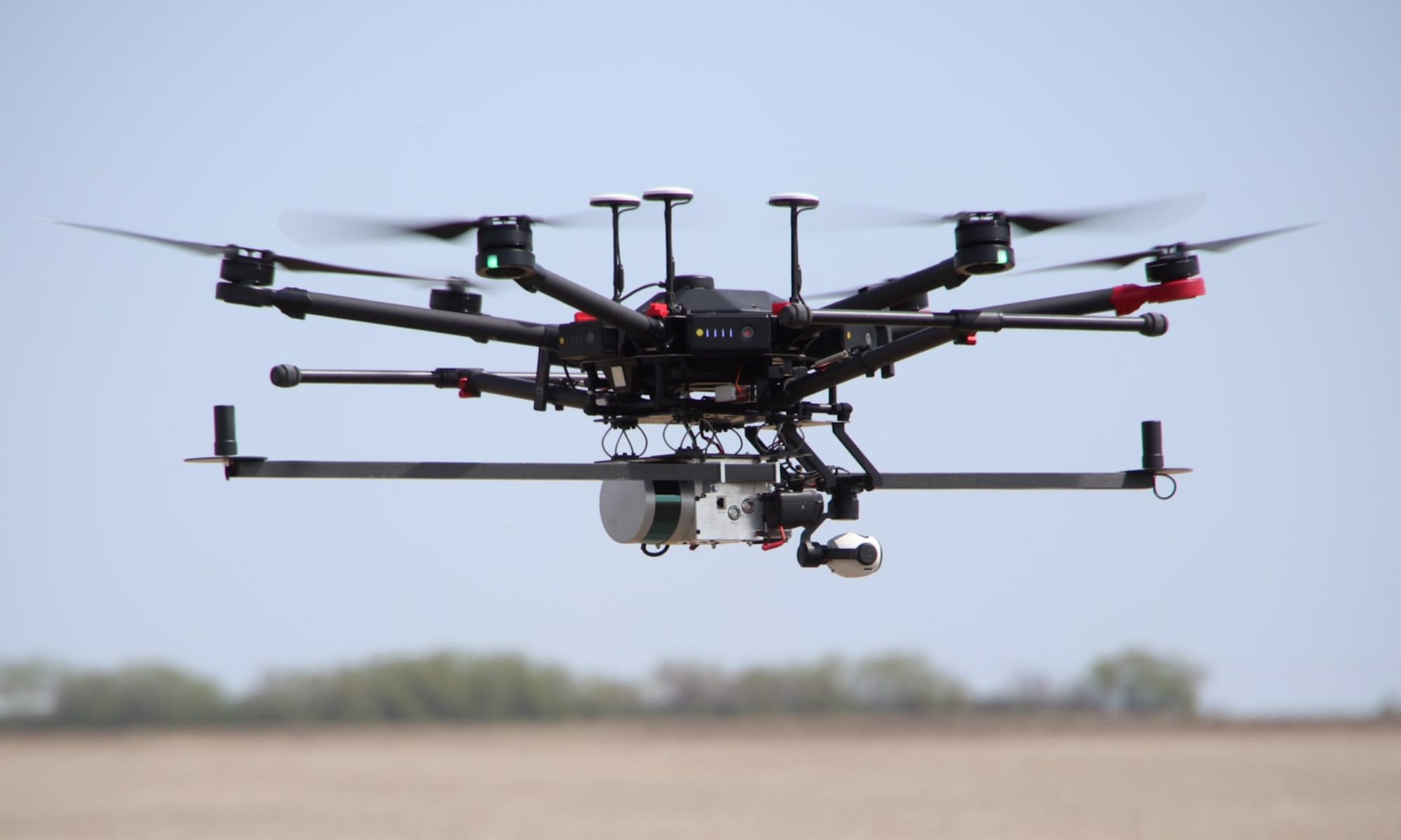
Steve’s research is focused on using low-cost uBlox ZED-F9P GNSS receivers and the Aceinna OpenIMU 300ZI IMU sensor to provide the directly georeferenced positions and orientations (i.e., trajectory) of a Livox Mid-40 lidar sensor for UAS-lidar mapping of archaeological sites. The research is leveraging the OpenMMS sensor firmware and post-processing software applications, and will hopefully be producing georeferenced lidar-based point clouds very soon. Great job, Steve! We are excited with your research and can’t wait to see what you come up with in the future!

OpenMMS on Open Science Framework

We are excited to announce that OpenMMS has found a ‘forever’ online home at Open Science Framework (OSF)! All the current (and future) OpenMMS documentation, design files, software, tutorials, etc. will continue to be available at openmms.org, but are also being archived to OSF.

Checkout the OpenMMS OSF project here

Open Science Framework (OSF) is the flagship product of the non-profit Center for Open Science. OSF is a free, open source web application that connects and supports the research workflow, enabling scientists to increase the efficiency and effectiveness of their research. Researchers use OSF to collaborate, document, archive, share, and register research projects, materials, and data.

Latest OpenMMS Video

This video simulates the data collection process for terrestrial mobile mapping using a handheld OpenMMS hardware sensor. This was the very first time the operators had ever used OpenMMS! Some areas within the project were GNSS-limited, but the tightly-coupled GNSS-INS trajectory was still accurate. Actual video footage recorded by the OpenMMS hardware sensor during the data collection is periodically overlaid for reference. All noisy data within the point cloud has been intentionally included to illustrate the cause of the noise and some of the challenges of terrestrial mobile mapping. The data collection took just over 9 mins to complete! The playback speed of this video is approximately 2X faster than the actual data collection speed.

At times you can clearly see the unique scan pattern of the Livox Mid-40 lidar sensor when it is projected on the walls and roofs of the surrounding buildings! In reality you don’t see these patterns, as the frequency of the laser is outside the visible spectrum and emitted at very low (eye-safe) power levels.

This video was created using Python, OpenCV, and Open3D. The entire workflow will soon be released as open-source to the OpenMMS GitHub repo.